
📊 Full opportunity report: The Eye Over The City: How Wide-Area Motion Imagery Works — And Where It Goes Blind on ThorstenMeyerAI.com — validation score, market gap, and execution plan.
TL;DR
Wide-Area Motion Imagery (WAMI) allows real-time, city-wide surveillance by capturing and archiving high-resolution images of every moving object. Its integration with AI enhances security and military operations but raises governance questions.
Wide-Area Motion Imagery (WAMI) is revolutionizing city surveillance by providing real-time, high-resolution imagery of entire urban areas, tracking every vehicle and pedestrian simultaneously. This technology’s ability to archive and rewind footage makes it a powerful tool for security, military, and emergency response, raising significant questions about privacy and governance.
WAMI systems use an array of cameras stitched into a single, gigapixel image, capable of resolving objects as small as six inches from altitudes around 17,500 feet. The imagery is processed through advanced pipelines to stabilize, detect movement, track objects, and archive data for later review. DARPA’s ARGUS-IS, with 368 cameras, exemplifies this capability, producing images that can resolve detailed features across a city twice the size of Manhattan.
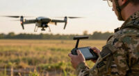
These sensors are mounted on various platforms, including aircraft, drones, and tethered aerostats, enabling persistent coverage of large urban areas. The primary use cases include military reconnaissance, border security, wildfire mapping, and disaster response, where WAMI’s forensic capabilities help trace objects’ origins and movements over time.
However, WAMI faces physical and operational limits: it is optical and thus affected by weather, requires loitering platforms within physical reach, and incurs high costs for aircraft hours and bandwidth. As a result, it is often paired with synthetic aperture radar (SAR), which can operate in all weather and through obstructions, complementing WAMI’s optical view. This layered sensing approach enhances coverage but also complicates data integration and governance.
The eye over the city: how Wide-Area Motion Imagery works — and where it goes blind
A normal drone sees through a soda straw. WAMI watches an entire city at once, tracks every mover, and records it all for forensic rewind. Immense reach — with hard limits that make radar and AI its necessary partners.
- City-scale motion, fine detail
- Forensic rewind
- Cloud / smoke / dark degrade it
- Needs a platform loitering overhead
sensing
+ AI
- Sees through cloud & total dark
- Tasked over denied airspace
- Persistent, wide-area from orbit
- Sovereign · on-prem · air-gap
The same archive that traces a bomber to a safe house can trace anyone home — retroactively, without prior suspicion. Baltimore’s secret 2016 deployment led to a 2021 federal ruling that persistent aerial tracking violated the Fourth Amendment. The security value is real; so is the mass-surveillance risk. Who owns the sensor, the archive, and the AI is the accountability question.
WAMI’s power is the archive and the AI reading it; its weakness is weather, airspace, and oversight. The mature posture isn’t optical-vs-radar or capability-vs-liberty — it’s layered sensing (optical WAMI + all-weather SAR), AI-enabled exploitation, and sovereign, auditable control of the whole chain. WAMI shows what a persistent eye can do with clear skies and owned airspace; for the cloud, the night, and the denied area, the radar layer is where the resilient coverage lives.
Implications of WAMI for Urban Security and Privacy
WAMI’s ability to monitor entire cities in real-time and archive detailed footage significantly enhances security capabilities for military, law enforcement, and emergency responders. Its forensic power allows for detailed investigations long after an event, making it a transformative tool in urban surveillance. However, this raises critical governance and privacy concerns, especially regarding data use, oversight, and potential misuse. The technology’s reliance on AI for data processing further complicates accountability and transparency, prompting legal and ethical debates about its deployment.

HXVIEW 4K PTZ Security Camera Outdoor with 50X Optical Zoom, High-Speed 360° Pan & 90° Tilt, 8MP WiFi Camera with 1200FT IR Night Vision, Auto Tracking, Person/Vehicle/Pet Detection, RTSP
50X Optical Zoom Security Camera: Equipped with a 50x optical zoom and autofocus lens, this camera allows you…
As an affiliate, we earn on qualifying purchases.
As an affiliate, we earn on qualifying purchases.
Evolution and Current Use of WAMI Technology
WAMI technology originated in the early 2000s with the Sonoma Persistent Surveillance Program at Lawrence Livermore National Laboratory. It transitioned to defense applications in 2005, with systems like DARPA’s ARGUS-IS and the US Air Force’s Gorgon Stare deployed on drones during conflicts in Iraq and Afghanistan. Over time, the systems have shrunk in size and expanded in application, moving from experimental rigs to operational tools used for border security, wildfire mapping, and disaster response.
The core principle remains: combining multiple cameras into a single, comprehensive view of large areas, enabling continuous, detailed monitoring. The integration of AI has been critical for processing the enormous data streams generated, making real-time analysis feasible.
“WAMI doesn’t replace radar or FMV; it complements them by filling in the optical gaps.”
— John Marion, former project lead at Lawrence Livermore

Ring Floodlight Cam Pro (newest model) — Retinal 4K with wide-angle video, 10x Enhanced Zoom, and 2000 Lumen Floodlights, 2-pack, White
More 4K coverage and light where you need it — With 2 Floodlight Cam Pro, Wired (2nd Gen),…
As an affiliate, we earn on qualifying purchases.
As an affiliate, we earn on qualifying purchases.
Unresolved Challenges and Limitations of WAMI
While WAMI’s capabilities are impressive, its dependence on optical sensors makes it vulnerable to weather conditions like clouds, haze, and smoke. Its requirement for loitering platforms within physical reach limits its deployment in contested or denied airspace. Additionally, the high operational costs and data bandwidth constraints restrict its widespread or continuous use. The integration with SAR sensors offers solutions but also raises questions about data fusion, management, and oversight, which remain under active discussion and development.

Drone XC 2K LTE/Wi-Fi/GPS Dash Camera with aftermarket Remote Start & Security Alarm System Integration
Will connect to an aftermarket remote start or security system
As an affiliate, we earn on qualifying purchases.
As an affiliate, we earn on qualifying purchases.
Future Developments and Policy Questions for WAMI
Advances in sensor miniaturization, AI-driven automation, and data fusion are expected to expand WAMI’s capabilities and deployment options. Researchers are exploring new platforms, including smaller drones and satellite-based systems, to overcome current physical and operational limits. Simultaneously, policymakers and courts are increasingly scrutinizing the governance of persistent surveillance, with ongoing legal debates about privacy, civil liberties, and oversight. The future of WAMI will depend heavily on technological innovations and regulatory frameworks.

PANOEAGLE 4MP Dual Lens PoE IP Security Camera Outdoor with 180° Panoramic Wide Angle,Smart Color Night Vision,Smart Motion Detection,2-Way Audio & Micro SD Slot(512G),IP67 Waterproof,NDAA Complaint
💡【180° Wider View Features 4MP Clarity】This 4MP dual lens security camera combines two 1/2.9" CMOS sensor into ONE…
As an affiliate, we earn on qualifying purchases.
As an affiliate, we earn on qualifying purchases.
Key Questions
How does WAMI differ from traditional surveillance cameras?
WAMI provides city-wide, real-time coverage with high-resolution imagery, capable of tracking multiple objects simultaneously across large areas, unlike traditional cameras which are fixed and narrow in scope.
What are the main limitations of WAMI technology?
WAMI relies on optical sensors, making it vulnerable to weather conditions, requires platforms within physical reach, and involves high operational costs and data bandwidth demands.
How is WAMI used outside military applications?
Beyond military use, WAMI is employed in wildfire mapping, disaster response, border security, and infrastructure monitoring, helping agencies respond more effectively to emergencies and threats.
What are the privacy concerns associated with WAMI?
The extensive surveillance capabilities raise questions about civil liberties, data management, oversight, and potential misuse, prompting ongoing legal and ethical debates.
Will WAMI be replaced by other technologies in the future?
WAMI is expected to evolve with advancements in sensor technology and AI, but it will likely continue to complement other modalities like radar and satellite imaging rather than be entirely replaced.
Source: ThorstenMeyerAI.com